No. 152: Hermitage Road Construction

IMG_2277

As of today, Hermitage Road is wired and mostly operational. The photo above shows the future SAL 1402, an engine leased–literally–from my friend John Moenius. John had two of the engines and wasn’t going to use them, so I offered lease one from him, just like the big railroads do. Lease Terms: One Dollar, but I’ve gotta decal, paint and weather it. The engine is equipped with a SoundTraxx Tsunami 2 DCC/sound chip and is the best runner I’ve got.

I was able to go from “wood to wired” and running trains in about 45 days thanks to using a lot of stuff leftover from the last layout, and getting organized before beginning construction.

IMG_2278

I planned, and did some focused buying, and collected everything needed over a period of about 60 days. Then, around November 1st, I started building.

Below. Most of the lumber for Hermitage Road, not including the backdrop fascia. Most of it is recycled from the old Ackley layout. I cut it about a month before I started construction.

IMG_2357

Below.  I went to the local German hardware store and they cut up a massive piece of masonite for me.  Free of course–service comes with the price.

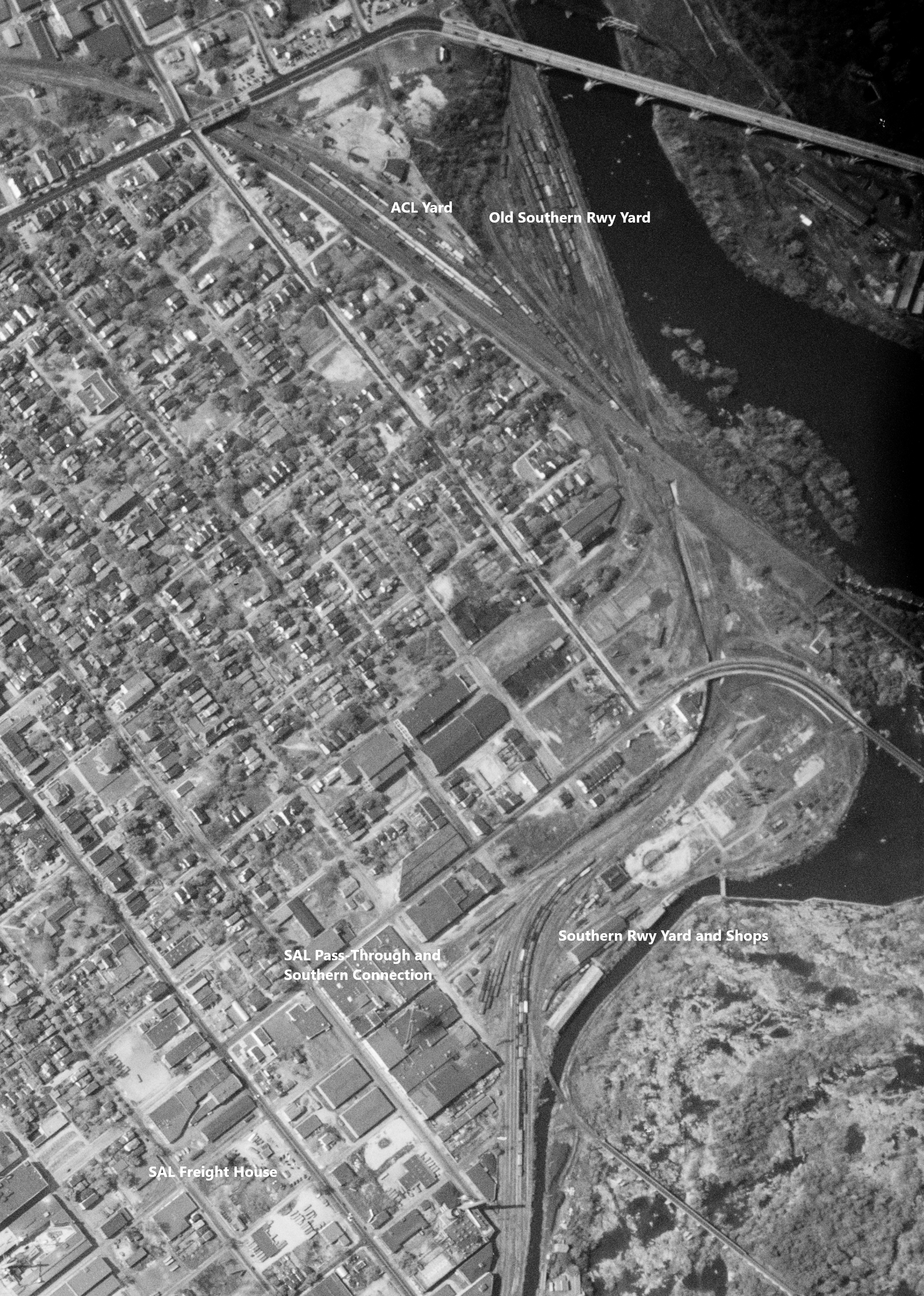
I mocked up the layout on the floor before beginning construction. I went through dozens of iterations, trying to get in everything I wanted while keeping it under 2 x 8 feet. Here’s one of the earlier five-feet-long mock-ups, below. The Richmond Cinder Block Co. is represented by the O scale boxes at the back right. The current track configuration is very close to this.

IMG_2146

Layout Constraints

The first constraint I faced was there is only about 15 feet available for a layout, with the back of the layout against a sloped ceiling.

IMG_1904

Second, because of the sloped ceiling, the layout is built at sit-down height, with the track elevation at 37 inches from the floor. Layout legs are simple–I’m re-using the Ikea Finnvard sawhorses from the Ackley layout, set at the “second peg”, making the Finnvard height 31 inches.

Backdrop height is 14 inches high to maximize as much space as possible against the sloped wall.

Benchwork was built in the traditional box-structure, 6-feet, 10 inches long and 17 inches wide. The subroadbed/layout base is made of a German product called “Styrodur” which is much like US blue styrofoam. Styrodur is more sturdy but is more brittle. I glued the Styrodur to the box frame and then screwed it down where possible to make sure of a secure fit.

IMG_1907

Roadbed

Used 4mm cork sheet for roadbed. I ordered it from Amazon.de (“German Amazon”) and it was here the next day. I completely covered the Styrodur with the cork. It was simple and fast, and prototypical as most of the industrial tracks in this area were sunken into the ground over time.

IMG_1978

Track and Turnouts

I used a combination of kit-bashed turnouts and Micro Engineering track. I used the Code 55 flex for almost all the tracks, but used all Code 70 turnouts. Two of the four turnouts are partially rebuilt Micro Engineering Code 70 #6s, and two are Shinohara #4 wyes that were almost completely rebuilt. I wanted to build all Code 55 turnouts but didn’t want to wait another 30-40 days so I could build them.

IMG_2075

All four turnouts were rebuilt with frogs and detail parts from Proto87 Stores and Details West. The photo above is of one of the two rebuilt Shinohara wyes. I basically used the track, replaced the frog, and replaced everything else. Now it is DCC-friendly. The tie plates are from Proto87 Stores.

I’ll talk more about track in a later post.

IMG_2043

Fascia and Valence

The fascia was cut from 3mm Masonite, once again left over from Ackley layout projects. I curved the fascia up at the ends about three or four inches from each end. See the photo below. I wanted to give the illusion that a few of the tracks continue past the valence and beyond the layout.

The light valance has two LED tube-lights mounted on the backs-side. These are German fixtures running at 220V.

IMG_2022

Wiring

Once again, I used almost everything from the Ackley layout. I bought some new feeder wire, and a 50-pack of suitcase connectors on Amazon. That was it.

I wired the layout up via the standard method, soldering feeders every three or four feet and in the appropriate places on the turnouts. I also installed Tortoise switch machines for all four turnouts. I powered three of the frogs through the Tortoises and one using a Tam Valley Frog Juicer. I still like using switch machines; they keep hands out of the layout, but take a lot more installation time and fiddling during installation. Like the last Ackley layout the switch machines are controlled in front using small toggles.

IMG_2342

Above. Testing the turnouts for power-routing problems. If there’s a problem, I mark it with a red pin and come back it to later.

Below. Under-layout wiring in progress. It’s messy work but was done in about a week.

IMG_2157

All wiring and plugs come out of the right side to make convenient connections the power system and the staging yard. Train control is my trusty NCE PowerPro.

Below. The wiring process in action!

IMG_2331

That’s it for now.  A not-very-exciting post but this one is important for archival reasons.  Meanwhile the trains are running…

IMG_2353

…and the track crew will be finishing a few more things to get ready for scenery.

IMG_E5608

I hope you have a wonderful weekend. God Bless America! – John G

No. 151: John Moenius’ Preston, Minnesota

My friend and fellow former-USAF navigator John Moenius is planning to model the Milwaukee Road in Preston, Minnesota. John was kind enough to send some words on his layout plan. Here’s John:

For the model railroader moving can be an emotional time.  The old layout you have spent hours planning and building comes down.  But at the same time new opportunities arise.  That was the situation I found myself in January, 2020.   At that time my wife and I decided to retire to a warmer climate and move from Kansas City to South Carolina.  I had a nice 26 foot by 13 foot shelf switching layout based on the FEC in Miami that was about 50% finished.  I had held a couple of operating sessions and had favorable comments.  But, down it came.  

FEC Final Run

We finally sold our house and made the move to South Carolina in October.  In South Carolina basements are a rarity, but I did have a FROG (finished room over garage) that had a 19 foot wall and the ability to add two eight foot wings on each end.  So what would be the next chapter in my modeling journey?   

Here’s a view of my new layout room, below:

New Train Room-Flipped

Some of the best advice I have received was from track planning/builder Lance Mindheim.  A good place to start is what does an operating session look like? I have operated on some big layouts in Kansas City.  I found I am more a builder than operator.  Operating a layout with eight people for four hours is not for me.  Bang a couple of boxcars together of 15 to 30 minutes, I’m good.  With all that in mind, what do I model?  

I envy those who had a railroad of their youth and know exactly what line they want to model.  When I was very young and living in Baltimore the Pennsy ran behind our house and I would watch trains for hours from my bedroom window.  So I do have a soft spot there, but it just seemed so big and I know of no interesting branch lines.  So many railroads, so little time.   As a start for some unknown reason I like railroads of the upper Midwest; CNW, MILW, M&SL, RI, CGW.   I also like Southeast railroads, seldom modeled and colorful.  And the Lehigh Valley too—I can’t figure that one out.

Below. Here’s my house on the far left (photo from Google maps).

View of Pennsy

My first thought was modeling the Seaboard, a railroad I really liked and central to my new home in South Carolina.  The main line was out; I do not want to model a bunch of passenger trains.  At first, I looked at modeling operations around the still standing Seaboard freight house in Savannah.  But others convinced me it would be operationally boring. 

Some fellow modelers online got me looking at the line between Savannah and Montgomery, a more rural line with no passenger service after early 1950s.  I just could not find a location that would work in my space and being a prototype modeler (sort of) I just did not want a generic town.

Below. Bellville, Georgia on the Savannah, Americus and Montgomery line–with a large lumber mill, some warehouses and a few other industries–was a consideration for a short time.

IMG_4042

Then I started looking at end-of-line branch towns using Sanborn Maps and historic aerial photographs.  Some of my favorites were Rock Island at Guthrie Center and CGW at Tripoli/Bremer.  I was getting close.

On Proto-Modelers on Group.IO John Golden posted this picture of Preston, Minn. on the Milwaukee Road.  Looking at that picture, Sanborn Maps and aerial photographs I found what I was looking for. 

IMG_9898

Preston was on a former narrow gauge line that ran from a junction called Isinours to Caledonia, Minn.  Preston was kind of unique in that it was the first town south of Isinours and also a stub end terminal.  Because of the light track the Milwaukee Road only ran SW-1s on the line, which the Milwaukee Road referred to as “donkeys”.  There are some great photos from the John Bjorkland Collection (Milwaukee Road East) at John F. Bjorklund Collection Highlights | Flickr showing a string of donkeys working the line in the early 1970s.  

IMG_2071

Brian Shumaker supplied the operational scheme for the layout.  In the early 1970s a string on donkeys would work the line once a week.   A decade earlier, in the 1960s, a lone SW1 was stationed in Preston.  In the morning it would go up to Isinours, pick up/deliver cars and return to Preston.  After turning the locomotive the crew would work the line south to Caledonia.  Arriving back in Preston, local industries would be worked and the train blocked for the next morning’s run back to Isinours.  So, although the string of donkeys circa 1970s were cool, the early 1960s operation with a single SW1 would be the operational focus.

Here is a Sanborn map, circa 1926, of the downtown area. The three-stall roundhouse was reduced to one stall in the 1960s.

Preston MN Sanborn 4

Below. A closeup of a track map from the online map repository on the Minnesota DOT site (dotapp7.dot.state.mn.us):

Capture 3

From the same site, here is a track map of the junction near Preston with the line to Isinours. There’s no room to include the junction in the layout plan, but the detail included in the map is very interesting:

Capture 44

I still needed a track plan.  I led a lot of discussion on the Proto-Layouts Group online for about a week.  Clark Propst and a couple of others mentioned the defining scene was the Preston depot and engine house.  I had a hard time developing a plan to fit my space.  Then Rich Gibson sent a track plan online, based almost exactly on the prototype, using Peco 83.  I had my track plan.  

Preston with Structures

Above. The track plan sketched up by Rich Gibson. The line on the shelf on the right would act as a fiddle yard to change out cars to/from Preston.

So I have started my new project by working on the depot. I want to thank all those for guidance and help; Clark Propst, Brain Shumaker, Rich Gibson and many others on Proto-Modelers on Group-IO.  Also, my modeling friends in Kansas City who helped me to improve my skills and knowledge over the years so I could take on this new project.

IMG_2070

My thanks to John Moenius for his article. I hope to present more on his layout in the future. 2021 is shaping up to be a great year for new layouts! – John G

No. 150: Hermitage Road

In October, 2019 my family and I moved from my house in Albersbach, Germany to a much more modern and efficient house closer to work. Doing so meant I had to dismantle my point-to-point M&StL Ackley, Iowa layout and move it to the new place. That wasn’t a big deal as I built the layout to move.

Above. The Ackley, Iowa layout nearly complete in 2017.

As I related in an earlier post, moving the layout did go so well. Most importantly, Ackley did not quite fit in the new layout space so I carefully stored it in the garage. As I contemplated building a new, smaller layout for the new space I thought it would be wasteful to buy things for a new layout when I already had all those things on the Ackley layout. Moreover, the Ackley layout got a little bashed up in the move. Eventually I decided to scrap it, and salvage it for parts, and move on.

I considered a lot of options for the new layout. I have covered in exhaustive depth my plans to model The Milwaukee Road freight house in Mason City. At the same time I also considered building a small layout based on the Illinois Central freight house in Champaign-Urbana. I also looked at the Illinois Central freight house in Decatur, and even planned a layout based on the huge Milwaukee Road freight house in downtown Minneapolis.  None of the plans worked out to my satisfaction.

Below. The back end of the IC freight house in Decatur. With the main line out of the picture on the right, and a few more industrial sidings on the left, I thought this area would make a great small switching layout.

IMG_2590

Allow me to back up a little bit. The genesis of this small layout concept is something I have called The Factory. The Factory concept is a small, 2 x 8-foot layout featuring a single industry that had a little bit of everything and offered just enough for a 20 or 30 minute ops session. I found a few factories that would work, such as Decatur Soy (in Decatur), and the American Radiator Company in Litchfield, Ill. I’ll do posts on both of these places later.

An example of The Factory is below–the American Radiator Co.–with map courtesy of my best friend Lonnie Bathurst. The plant was in Litchfield and was served by the Big Four. The plant had a need for coal (gons and hoppers), sand (gons and hoppers), fuel and lubes (tank cars), machinery and raw materials (box cars), and out-shipping in box cars. Probably some stuff on flat cars too, as there is a gantry crane seen in photos. That’s lots of different kinds of cars to handle. It’d make a nice, small layout–perfect for a 30-minute ops session.

IMG_6829

The American Radiator Co. concept worked, but it just didn’t scratch the itch.

Finally, one evening in October, while looking at railfan slides and some maps of the RF&P and Seaboard switching districts on the north side of Richmond, Virginia, I found a switching area that had just about everything. There wasn’t one large industry, but a layout based on a variety of small rail-served customers in this area offered an opportunity to use a lot of different freight car models. The area was pretty generic so I felt like it could be Anywhere USA, just as the old Ackley layout was.

The area is located right behind the old SAL yard, alongside Hermitage Road. Thus, “Hermitage Road” was born.

Below. This is another Bill McCoy photo of Hermitage Yard in north Richmond. The tracks at the far left are the RF&P and ACL main tracks to Richmond’s Main Street Station. The tracks immediately below are the SAL main tracks to the RF&P Acca yard, which is in the far background. The area being modeled is behind the engine shop at the far right.

SAL 1474 - 1470 Hermitage Yd., Richmpnd, VA 12-57 - Copy

Unlike every other layout I’ve ever built in my life, Hermitage Road doesn’t follow an exact prototype arrangement.  Instead, it combines features of four different industrial tracks and puts them into one place.  I call it a “composite layout”.

Below. Here’s an aerial that shows the basics. SAL’s Hermitage Yard is at center. The big wye is the ACL-RF&P connection to Richmond’s Main Street Station, which is just out of view at the bottom right. Hermitage Road is the four lane road crossing at right from top to bottom next to the old baseball grounds.

Hermitage Yard Aerial

The layout is 6 feet, 10 inches long and 17 inches wide, with room for a staging yard less than six feet long. Hermitage Road has just six industries and a team a team track–at most 13 spots. There is no run-around and no complex track or features. There are only three tracks, one with a short switch-back. That’s it.

As you can see below, the layout is well underway and all the track on the visible layout has been secured. The staging yard will be built when the visible layout is completely wired and operational.

IMG_2230

The six industries selected represent the wide variety of customers served behind Hermitage Yard.  Actually a few of them were just off of Ellen Road, and I thought long and hard about naming the layout Ellen Road as a tip-of-the-hat to a favorite English football club, Leeds United, who play at a stadium called Elland (with a d) Road.  For the layout, I like using the word Hermitage better—it is more descriptive, and I like the association with the old Seaboard yard and also the word’s Christian heritage.  So, Hermitage Road it is.

In early Christianity, a hermitage was a place where Christian men lived on their own to escape the temptations of the world. According to Wiki “…these retreats were caves or small buildings in deserts, mountains, forests or on islands.” In a way, Hermitage Road is my place to escape the world to relax and play trains.

Below. I’m hoping Hermitage Road will look something like this. This 1991 photo was taken in a SAL-Southern Rwy switching district on the south bank of the James River.

VA RR Photos, Jun 2005 (40)

Here’s a short breakdown of the industries and tracks:

  1. The track nearest to the aisle includes an unnamed grocery warehouse, an unloading ramp/team track, and the Southern Fuel and Oil Co.  Five spots total.  The grocery warehouse can take refrigerators, box cars and ventilated box cars.
  2. The center track serves one customer, the Hermitage Coal Co.  which can accept hoppers and gondolas, and even box car loads of coal.  Two to three car spots will be available.
  3. The track farthest from the aisle has two industries, the Alcatraz Paint and Varnish Co. and the Richmond Cinder Block Co.  The Richmond Cinder Block Co. is the largest of the industries on the layout; it receives raw materials via hoppers, gondolas and covered hoppers and can ship out blocks in box cars or gondolas.  About four car spots total.  The Alcatraz Co. can take box cars and tank cars–one of each.  Alcatraz also had an asphalt side-business so that will drive a demand for an additional tank car when needed.  

This variety of industries allows me to use box cars, tank cars, flats, gons, hoppers, vents and reefers.  For a freight car modeler, it’s perfect.

Below: The concept photo for the small Hermitage Coal Co.

GVMI7088

The layout is designed to be somewhat like an English cameo layout.  English cameo layouts usually feature a very simple design and an operating area entirely framed by fascia top-to-bottom.  Hermitage Road is framed in a similar fashion. It is constructed of lightweight materials and will be easy to bring downstairs for parties or to RPM meets or other events.

Here’s what the little layout looked like a few weeks ago, below, as I was still mocking up structures. As of today the layout is completely wired up and operating.

I hope you and your families had a wonderful Christmas celebration, and are looking forward to a great year ahead. I am! – John G

No. 145: Milwaukee Road’s Mason City Freight House

In the beginning of August I took my family away to the Solk Pass, Styria, Austria, for a quiet mountain getaway.  We rented a little cabin literally in the middle of nowhere and hiked the weekend away.  It was wonderfully relaxing.

IMG_1767

Right out of our cabin we hiked to several mountain lakes.  This is the Kaltenbachsee, which translates to “cold river”.  The hiking was rugged, the lakes were beautiful, the water ice cold.  The kids are taking it easy after a two-hour, uphill-all-the-way hike.

IMG_1846

On our last day we drove to the nearby village of St. Nikoli and hiked six miles to another mountain lake called “Hohensee”, which translated means the High Sea.  Elevation was around 3,000 meters, or about 10,000 feet.  It was stunning–the best hike I’ve ever taken.  Below, the kids are heading down to the lake for a dip.

IMG_1946

The nearest railroad was about 12 miles away.  I was able to stop briefly and caught a meet between a passenger train, at left, and a work train.  The passenger train took the station siding and slowed to a crawl while the work train–seen heading at us in the distance–sped by.  Unfortunately I had to shoot into the sun and this was the best photo I got.

IMG_1700

The Freight House

I’ve been thinking about a building a small, city-themed switching layout for years.  I laid out a concept plan for the Milwaukee Road’s Mason City downtown branch in a previous post, which can be found at https://wordpress.com/post/railroadprototypemodeler.wordpress.com/10751.

In the last year or two I’ve been kicking around ideas for two very small layouts, one of which I call The Freight House and the other which I call The Factory.  Inspiration comes from, among other places, Chris Nevard in England.  I’ve mentioned Chris’s work before before.  I highly recommend a tour of his Flickr and Blog sites as they are full of great ideas and outstanding modeling.  Here’s a link: http://nevardmedia.blogspot.com/.

Below.  Here’s a snap of one of Chris’s layouts, Fountain Colliery, used with permission.  This is a small layout with enough potential to keep you switching cars for an hour or so.  It is the inspiration for The Freight House.

37847576322_b57298ec3d_h

My thoughts on The Freight House are an 8 x 2-foot, city-themed layout with a large railroad freight house as the centerpiece and a few supporting industries filling in the spaces.  An eight-foot staging “tail” is also essential.  Here are a few places I have considered:
1.  The Seaboard Air Line freight house in Savannah, Georgia.  I grew up in Savannah and know this area well.  The SAL freight house is at center, below, and there are a number of other small customers on the SAL tracks on the left.  Just enough for a small, balanced layout.
IMG_2041

2.  The Illinois Central freight house in Champaign-Urbana, Illinois.  The freight house and a few other nearby industries, turning off the main IC artery through town, is a strong candidate.  Interchanges with NYC, Illinois Terminal and Wabash are at the top of the photo.  Another good candidate is the still-standing IC freight house complex in nearby Decatur, Illinois.

IMG_1972 (1)

3.  This is the B&O depot and freight house complex in Pittsburgh, Pennsylvania.  Freight houses, a heavy transfer crane, some industries, and REA traffic (switching passenger-express cars?) would make a fun and different little layout.  This is too big to model in 8 x 2, but double the size and it’d be a great layout.

IMG_9322

4.  Finally, the Central of Georgia terminal in Savannah, Georgia, just across the canal from the SAL freight house (which can be seen in the background).  The large Central freight houses, with a dozen tracks for box cars, reefers and vents, and other tracks for coal, sand and lumber dealers, would make an awesome terminal layout.

IMG_2044

Below is the image Clark Propst provided of the Milwaukee Road Mason City freight house, circa 1948.  The freight house is the center piece, but there are other industries all over the place that could be included.  This is my favorite candidate for The Freight House but the problem is I haven’t been able to lay out a track plan that is modelable while maintaining the  prototype track configuration.
Capture

The Problem:

The Problem with planning this layout isn’t necessarily the layout.  It is what I want that is the problem.  The Givens and Druthers that John Armstrong made famous.  

I want a small layout that features everything in 8 x 2: The Freight House, plus supporting industries that require the use of flats, covered hoppers, gondolas, tank cars, and hoppers.  I want it all–in 8 x 2.  And it has to be prototypical.  It’s practically impossible.  THAT is the problem.

In a movie I saw 30 years ago, Clint Eastwood said “A man’s got to know his limitations.”  Clearly I don’t know mine.

So after a month or two of frustration I decided to let go of the prototype track configuration to a certain extent, but that led to a lot of freelancing.  That didn’t work either.

Then I tried “flipping” the scene.  I flipped the photo, re-orienting things so the  freight house is in front with the freight house tracks closest to the layout edge.  The brick buildings in the back would be along the backdrop.  That’s much better.

SL4761, 9/17/38.  Roosevelt Stadium. Night football photos (ALSO AERIAL VIEWS)

Below.  Here’s a Sanborn map, also flipped.  The important element of the flipped arrangement is the freight house–a single-story structure–would be “in front”, meaning along the aisle nearest to a layout operator.   In this configuration an operator isn’t reaching across buildings to uncouple cars.

Sanborn_Fire_Insurance_Map_from_Mason_City,_Cerro_Gordo_County,_Iowa._LOC_sanborn02743_007-11

Here’s another flipped view.  To the left are a power house and a lumber dealer.  It would be possible to put the freight house in the center of the layout and have other industries on the left and right, with expansion opportunities in each direction.

SL23100, 3/30/52. Mason City downtown aerials

I spent months track-planning it out on the floor.  In the photo below, this was about as close as I could get, with the Kato boxes standing in for the freight house.  It is flipped and completely full of freelancing.

Making things worse, this is 14 x 2-1/2, not 2 x 8.  And there’s only two feet left for a staging yard.

IMG_2067

It still doesn’t work.  And no matter what I do, I can’t make it work in the space I’ve got.

At times like this I have to remember: Model Railroading is Fun.

– John G

No. 136: More Modeling Considerations – The West Belt Line

Over Christmas, I took my family skiing in the Tatras National Park in Slovakia.  We usually ski in Austria but this year we wanted to try something different.  We stopped halfway for a nice night in Prague, enjoying the Christmas markets there, and on the way back we spent two days in Poland.  It was a great trip—very different.  By the way, the skiing in Slovakia was good!

Of course there were trains everywhere, and I was able to break away from the family one morning and spent an hour chasing trolleys in downtown Prague.  Driving east through the Czech Republic we drove alongside a railroad line for quite a while and my wife shot this photo as we paced a local passenger train.  The rear end of this train reminded me of some U.S.-style doodlebugs from the 1940s and 50s.  This was December 24th.

IMG_1646

Meanwhile, back in Germany, I had been looking at modeling something along the West Belt Line in St. Louis for some time.  Right now I’m pretty certain I’ll model the Milwaukee Road in Mason City, but the West Belt is quite a draw.  Here’s a story that you might find interesting.

The West Belt Line—ironically located in North St. Louis—was a center of industry, commerce and interchange.  The right-of-way, which spanned north St. Louis from the Mississippi to the western suburbs, was Rock Island’s main line to St. Louis and much of the trackage was also shared with the Terminal Railroad Association.

Aerial photos from the mid-1950s show how industrialized this area was.  Hundreds of rail-served industries, large and small, lined the West Belt.  There are a number of areas that provide great motivation for a prototype model railroad.

The view below shows the most industrialized part of the line.  The West Belt can be seen entering the photo at the overpass at lower right.  Rock Island’s main St. Louis terminal is just a few miles east, just out of the photo on the right.  At the lower left, the West Belt turns southwest into the Missouri countryside.  The major highway going left to right used to be Bircher Avenue and is now I-70.  This is 1955.

RI Belt Line Large

Below is an excerpt from a Terminal Railroad Association map, circa 1960.  This map depicts some of the sidings and industries, although the detail is not so great.  You should be able to match up the major industries above with their identities below.  The complex of tracks in the upper left of the photo and the map are defense industry lines, with the famous ammunition plant at the very top left in the photo above. 

IMG_9060

Of particular interest to me is the small, heavily industrialized area that parallels Geraldine Street.  In the photo above, this area appears at the center-right and looks like an artery with blood vessels spreading out in all directions.  Below is an aerial close-up of the same area.  The Belt Line can be seen crossing at top, right to left.  Download this photo and study it.  There are dozens of customers and box cars tucked in everywhere.

RI Belt Line Detail

I have to admit that I lived in St. Louis for nine years and never knew this place existed until I bought aerial photos from the USDA last year.  Here’s a fuzzy close-up below.  Look at the amount of industry packed into this area, and all the branches radiating through the adjacent blocks.

IMG_9060 - Copy

Here is a closer view, below, of the top half of this district.  Hoppers are at Philadelphia Quartz.  Box cars are all over.  Note the loading ramps extending out from some of the structures.

RI Belt Line Detail Top

I visited the area a few years ago when I went back for a St. Louis RPM event.  The lead off the Belt Line to this area still includes a three-way switch.  See it in the aerial above?

IMG_0233

Below.  Retired tracks are still everywhere.  I imagine many of the streets were originally brick or cobblestone.   That’s Richard Brick in the background; it has always been a major shipper on this branch.  Many of the bricks were fired at a plant east of St. Louis–at Edwardsville, Illinois–which was served by the Nickel Plate.

IMG_0263

Below.  Here’s a modern view of part of this area from Google Earth, looking east down Brown Avenue.  I considered modeling this exact area.  I like the big industries and how some of the buildings are truncated to allow tracks to pass by.  I even considered modeling this area on a 4 x 8 and have deep sidings.  That would be different, but it would consume a lot of space.

j,kjk,

Below.  Here’s a photo I took of the same area as seen above.  Love the big buildings and the tracks in the street.

IMG_0197

Many of the big factories are now abandoned, but the fronts look like this.  The backsides of all these building were rail-served.  This is American industrial architecture at it’s most best!

IMG_0275

Some of the tracks crossing Penrose and Geraldine sneak through buildings and obstructions like this shown below.  At left is a steel shapes distributor.  It can be seen clearly in the aerial photos at top.  They probably had loads delivered in gons.  The building at right was curved to meet the track geometry.

IMG_0253

Below.  Here’s about the same area, thanks to Google Maps:

IMG_1528

A few more snaps below, showing the variety of buildings and locations of tracks.

IMG_0198

This old plant on Farlin Avenue, below–which I think used to be General Cable–is being reclaimed thankfully.  I count at least seven loading dock doors for box cars.

IMG_0245

I understand the Terminal Railroad Association Society had a paperback book published on the West Belt a few years ago, but I haven’t been able to get a copy from Larry Thomas despite my begging.  That book may provide more information on the line and this area in particular.

In preparation for the new layout I’ve been building a lot of new turnouts.  Below is a #5, Code 55 under construction built with Central Valley tie strip, Micro Engineering rail and Proto87 Stores parts.


IMG_8488

Progress is slow, unfortunately, thanks to my new Belgian friends Leffe, La Choufee and Westmalle.

IMG_8378

Oh, and here’s one last fun photo for you modern modelers, as seen on Google Earth.  Check out this grab of a plant nearby the area discussed above, just off Union Avenue.  Look at the tight track and all the transformer flats.  I can see at least one Critter too.  This place is a layout in itself!

IMG_1366

With much love and admiration

– John G

No. 135: Almost Perfect – Modeling the Milwaukee Road in Albert Lea

I was on the way back from a work trip to the U.S. Embassy in Rabat, Morocco a few weeks ago when I wrote this post. The travel day back home to Germany was an epic adventure and not in a good way. I expected a 10-hour travel day but got a 22-hour travel ordeal instead. Lufthansa gave me an extra present at the end of it all by losing my luggage.

Anyway the extra nine hours I spent in the airport in Rabat, sitting and waiting for a flight, were used to write this post and a couple more. Among other things, I had plenty of time to contemplate prototype locations for the new layout.

One of the locations I’ve been looking into is the compact Milwaukee Road main mainline through Albert Lea, Minnesota. Albert Lea is a small city in couth central Minnesota. A Milwaukee Road secondary line running westerly from the area north of Austin, Minnesota served the city.  This photo and several others below are courtesy of Doug Harding.

Albert+Lea

Albert Lea would be a smashing place to model. In the Standard Era, Albert Lea was home to a large M&StL terminal (by M&StL standards, that is…) and a large Rock Island yard. IC also had a presence. The Milwaukee ran east to west through town and crossed the M&StL and Rock Island twice. There were industries on both sides of the tracks through town, plus an engine house with a small turntable, a cool freight house, and a few large shippers. It has everything to make a perfect one-town layout.

The photo above shows the Milwaukee running from the bottom right across to the top left. The M&StL yard is at the bottom left. To study the photo in some detail you’ll have to download it, but most of the major features of the Milwaukee’s right-of-way in town can be seen here.

Below is a map of the Milwaukee in Albert Lea, circa 1950s.

ALbert Lea jpeg
Below.  Here’s an excerpt from a Milwaukee track chart book that provides a few line-specific details:
Milwaukee Route Through Albert Lea

I wish I would’ve taken a closer look at Albert Lea ten years ago before settling on Ackley. This would make a great layout.

In the last month or so I’ve looked at modeling the town in two segments: 1) The East Side, and 2) The West Side.

Now let’s look at some details. On the East Side, Milwaukee served a large Hormel packing plant and shared the switching duties with Rock Island. Milwaukee also maintained a small engine house and turntable near the plant for local engines and anything else that needed a spin. Milwaukee crossed the Rock Island twice here; one Milwaukee track was the east-west main, and another was a short industry spur into town that served a few customers and a power plant. See the track chart below.

img_7028-e1577394717693.png
What I call the West Side is contained by the two crossings.  This is the neat part.  Jammed between the Rock Island (east side) and Joint M&STl-RI crossing (west side) were a large number of small shippers—elevators, coal dealers, etc.—plus the freight house, interchange/transfer tracks, and the Milwaukee’s passenger station.  Check out the drawing below:
West Side Albert Lea
Below.  Here’s the exact same view today-view, courtesy Google Earth.  The RI main on the east side is still there, along with the brick interlocking tower (all UP).  The Joint track crossing on the west side is gone, along with the entire M&StL facility.  Remaining are the Milwaukee depot, freight house, and a number of the original industries.
IMG_7198.jpg
Check out these Google Earth images.  Here’s what I call the East Side.  You can see the former RI crossing and tower, and the Milwaukee depot, and a few of the lineside customers.  Beyond the tower is the site of the turntable and engine house and the packing plant complex.  The tower over the old Rock Island still stands, but it’s hard to see.  You can just see it’s shadow across the tracks and the crossing.
img_7201.png
Below.  Here’s the west side where the RI-M&StL Joint track crossed.  The old roadbed goes right to left across the bottom of the photo.  Plenty of old customers are still there.
img_7199.png
Here’s a Google Streetside view of the same area below.  This was all part of a mill complex and was also the location of a transfer (interchange) track.  The former Milwaukee Road tracks are still in place; the RI-M&StL Joint Line–gone now–crossed right to left in the foreground.  You can see a few more of the trackside customers along the Milwaukee in the distance.
IMG_7210 (2)
Here’s one more interesting aerial view, this from Doug Harding’s M&StL collection showing the entirety of the M&StL yard.  The Milwaukee can be seen crossing at the bottom from left to right.  The mill mentioned above can be seen below on the bottom right near the crossing.  There was no tower here and I need to research what sort of protection existed at the crossing.
119 Albert Lea MN Looking North
Here’s an eastward view of the Milwaukee freight house, which still exists near the old depot.  There were four or five tracks here and things were busy in the heyday.
img_7208.png
The cool brick depot and small manufacturing plant across the tracks give the place a big-town feel.
4518935633_f564162a28_z

West of the Joint Track crossing there was a whole lot of nothin’. It’s beautiful Minnesota farm country though—definitely worth spending a little time modeling it.

Man, this is almost perfect for modeling. The variety of little shippers jammed between the crossings would provide a modeler with a lot of switching options in a very small space. The freight house has a huge cool factor; freight houses were signature structures on every road. The packing plant on the east side is the important “big industry” in town—they needed stock cars, box cars, meat reefers, and tank cars in big, steady quantities. The M&StL-RI interchange would serve as the all-important “universal industry” so you can route any car there any time.

Below.  Here’s an aerial of the Wilson packing plant, circa 1952, which was originally Albert Lea Packing.  Hormel had a plant about an hour east in Austin, Minneota–also served by the Milwaukee.  Thanks to Doug Harding for the photo.

Albert Lea Wilson plant 1952

What I didn’t have for this post was an employee timetable from the 40s or 50s showing train frequency. I’ll try to get that and update this post later. I sure would like to know if this was mixed-train territory.

My good friend Barry Karlberg sent me some words on Albert Lea that you’ll enjoy.

Hi John,

I grew up in Albert Lea from 1947 to 1960 and recall the Milwaukee Road depot and industries quite well. I spent time around the depot in my elementary school years when the local switcher was a steam locomotive and the big industry was the Wilson Meat packing plant. I also recall at about 5 or 6 years old riding in the cab of a steam engine, likely a 4-6-0 which pulled a passenger, not mixed, train west and my brother and Dad rode it to Alden. I believe the turntable was used to turn the engine which handled the 40 mile, St. Clair branch which diverged just west of Albert Lea. There was a wye at St. Clair to turn the engine/train for return to Albert Lea. Industries east of the depot were the Wilson plant stock inbound and tallow and meat out bound. Then there was the spur east to feed the Interstate power company generating plant plus the Jack Spratt grocery warehouse. These were all on the north side of the railroad. In front of the depot (south side) was a fairly, large, machine shop (Albert lea Tool Co, ?) then further west Albert Lea Elevator feed mill which later became Donavan feeds. North side west of the depot was the freight house and an oil bulk plant (maybe Mobil red tank cars) and then around the Milw.-M&STL curved interchange track there was also some other small manufacturing plant. West of the Milwaukee/M&STL/IC crossing was on the northside was the large, Universal milking machine, plant and on the south side on a siding was stock pen and a gas plant. Further west after going under Highway 65 (?) was a long spur which fed the Smith Doughlas Fertilizer plant and took tanks and small covered hoppers. Then a bit further west was the jct. switch for the St. Clair branch. The Milwaukee Road didn’t have much of a yard just a couple of sidings east by the engine house/ turntable to handle pickups and setouts for the Austin- Wessington Springs through freights. Looks like a portion of the railroad could be very modelable.

Happy New Year to you and your family.

Barry

SO WHAT’S THE DOWNSIDE?

The downside is I can’t model it in 19 feet. That’s it. I think I’d need 30 feet to do it right, end-to-end, plus space on each end for staging. What do you think?

THE NEW TRAIN ROOM

The new “train room” is much smaller than I had in the old house. Useable space is only 30 x 10, and I have to share the room with a small den and the family computer/study area. The room has a window (third floor!), a nice skylight and as of this writing, my workbench is already set up and in operation. It is not a big space, but I love it–it is cozy and inviting–and perfectly suited for a small sit-down layout.

IMG_7660

There are quite a few more posts in the queue, but life is busy. I hope you are all having a wonderful, blessed Christmas celebration!

– John G


No. 131: New Layout Considerations – SAL’s South Richmond Industrial Line

With our upcoming move to a smaller house in Ramstein village, which includes a much smaller train room, I’m considering options for a new, smaller layout.  The Ackley layout will be stored in the garage and hopefully survive the move back to the US in a year or two.

I don’t have the exact dimension for the new train room yet, and no details either—like, for example, which way does the door open into the room—so I’m not able to do any detailed layout planning.

Nevertheless, I’ve spent quite a few hours this week studying a short Milwaukee Road freight house branch into Mason City, Iowa.  Clark Propst has supplied me with maps and lots of great photos.  Studying that line has reminded me of another industrial line I have studied for 30 years–the Seaboard Air Line branch into the Manchester area of South Richmond.  I thought this would be a good time to write about that line.

196

Above.  Here’s the centerpiece of SAL’s branch into South Richmond, the freight house on Hull Street.  This is a mid-1950s view courtesy of the Richmond Times Dispatch newspaper archives.

Richmond was the northern hub of the mighty Seaboard Air Line.  In the heydey, SAL had a triple-track mainline through the city, three yards, and several busy industrial branches that reached into deepwater ports and downtown areas.  Another branch left the main line at Bellwood and went east to Hopewell; that area is still crammed full of large rail customers today.  Richmond was also the site of the famous triple crossing which Seaboard shared with Southern and C&O.

A mile south of the James River was SAL’s South Richmond Yard, built at the onset of World War II to gather cars for industrial customers in the busy South Richmond/Manchester area.  Here is a circa-1952 aerial view, below, of the South Richmond area.  The SAL triple-track mainline is at the bottom; South Yard is to the left just out of the picture.  The branch into South Richmond can be seen leaving the main line at the bottom left.   The bracnh proceeds up Hull Street and is lined on both sides with factories, lumber yards, cigarette factories, and other industries.

Download this map and study it carefully.   The SAL line travelling up Hull Street branched off in four different directions to serve a large number of industries all over the area.  The large bank of buildings in the top left of the photo, I understand, were military supply buildings which were constructed during the World War II years.  You can see the SAL tracks–which crossed US 1 to reach them from two different directions–winding all around them.SAL South Richmond 2

Below.  This is a vintage topographical map of the South Richmond area, circa 1930.  The SAL South Richmond/Hull Street branch is seen at the bottom right running diagonally to the left.  The line travels up Hull Street and eventually connects to the Southern Railway’s shops on the James River.  Southern’s small classification yard is along the river to the left; ACL’s yard can be seen alongside the Southern yard.

Central Richmond West - Copy

Just for fun…here’s a photo of the ACL yards along the river, courtesy the Old Dominion Chapter, NHRS, showing the roundhouse and coal wharf.  In the distance, across the river, is Richmond.  SAL didn’t reach the ACL here, but SAL did reach the Southern just around the far end of the yard to the right.  ACL’s big yard in Richmond was Acca, shared with RF&P.

See the source image

The centerpiece of the SAL branch is the freight depot on Hull Street.  I’ve included this picture a second time so you can follow along easier.  This time, note the streetcar tracks corssing the SAL here.  Sanborn maps indicate there were at one time four streetcar tracks crossing here.

196

Below is another view from the 1952 aerial, showing the SAL line coming into the photo at the bottom left, proceeding past the freight house, and then passing through the large former-Phillip Morris building to reach the Southern Yard and shops.  I was once told that the SAL-Southern connection included a connection for both roads with the ACL, and the aerial photo seems to indicate such a connection just around the corner may have indeed existed.

SAL South Richmond

Below.  Here’s a view from Google Earth, looking south toward the old SAL main line at the old SAL freight house.  Miller Manufacturing buildings are at the back left.  The large factory at the top right, just barely visible, was a Phillip-Morris plant–also SAL served.  Easily noticeable is the curved walls in the factories to the right where tracks were laid.  Magnificent view!

IMG_6931.jpg

Here’s the back end of the freight house, around March, 1983, showing some of the tracks still quite visible in the street.

South Richmond 4

Turning around, and facing the back down to the main line, is this view of the Miller Manufacturing Co.  Again this view is around 1983.  The Miller Company still owns a number of buildings in this area.   This is one of the many big factories that lined Hull Street–all of them served by SAL.

South Richmond 7

This view, below, from around 2005, shows the pass-through to the Southern Yard.  I believe this used to be a Phillip-Morris plant; now it is operated by Alcoa.  The tracks are long out of service.

Why is the pass-through such a big deal?  For modelers, this track provides an interchange with another railroad among dense city tracks.  That is something that is very rarely found, and important for model railroad considerations.

VA RR Photos, Jun 2005 (43)

A short distance from the freight house is another short SAL spur that runs nearby Southern’s South Richmond station.  In the view below, we’re looking down SAL tracks laid in the curb, with Southern street track crossing left to right.  Very interesting stuff!

VA RR Photos, Jun 2005 (40)

It has been awfully fun studying the SAL lines around South Richmond all these years.  Back in the U.S., in long-term storage, I have a large file cabinet full of photo prints and maps of the area.  I wish I had it all to share now.

I was always sure I would model this area someday.  I’m sure it would make a great model layout, if one could model from the main line connection, up Hull Street, and through to the Southern Yard for interchange.  Typical power were engines like this one, below–one of SAL’s 50 F-7-class heavy 0-6-0s.  Here the 1133 is shoving hard at SAL’s Hermitage Yards in North Richmond.

IMG_2761

For now, I’m looking hard at the Milwaukee Road in Mason City.  But maybe someday…

And one parting shot.  Here’s a date nail still buried in the SAL tracks at the old freight house.  I wonder who pounded it in, almost 90 years ago…

VA RR Photos, Jun 2005 (53)

Enjoy your holiday weekend!  – John G