
Over Christmas 2019, I took my family skiing in the Tatras National Park in Slovakia. We usually ski in Austria but this year we wanted to try something different. We stopped halfway for a nice night in Prague, enjoying the Christmas markets there, and on the way back we spent two days in Poland. It was a great trip—very different. By the way, the skiing in Slovakia was good!
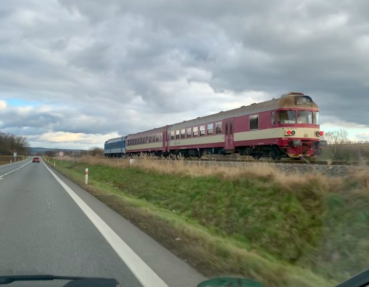
Of course there were trains everywhere, and I was able to break away from the family one morning and spent an hour chasing trolleys in downtown Prague. Driving east through the Czech Republic we drove alongside a railroad line for quite a while and my wife shot this photo as we paced a local passenger train. The rear end of this train reminded me of some U.S.-style doodlebugs from the 1940s and 50s. This was December 24th.
Meanwhile, back in Germany, I had been looking at modeling something along the West Belt Line in St. Louis for some time. Right now I’m pretty certain I’ll model the Milwaukee Road in Mason City, but the West Belt is quite a draw. Here’s a story that you might find interesting.
The West Belt Line—ironically located in North St. Louis—was a center of industry, commerce and interchange. The right-of-way, which spanned north St. Louis from the Mississippi to the western suburbs, was Rock Island’s main line to St. Louis and much of the trackage was also shared with the Terminal Railroad Association.
Aerial photos from the mid-1950s show how industrialized this area was. Hundreds of rail-served industries, large and small, lined the West Belt. There are a number of areas that provide great motivation for a prototype model railroad.
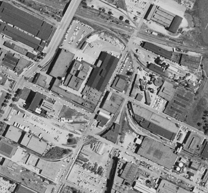
The view below shows the most industrialized part of the line. The West Belt can be seen entering the photo at the overpass at lower right. Rock Island’s main St. Louis terminal is just a few miles east, just out of the photo on the right. At the lower left, the West Belt turns southwest into the Missouri countryside. The major highway going left to right used to be Bircher Avenue and is now I-70. This is 1955.
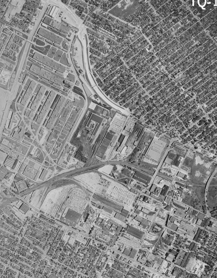
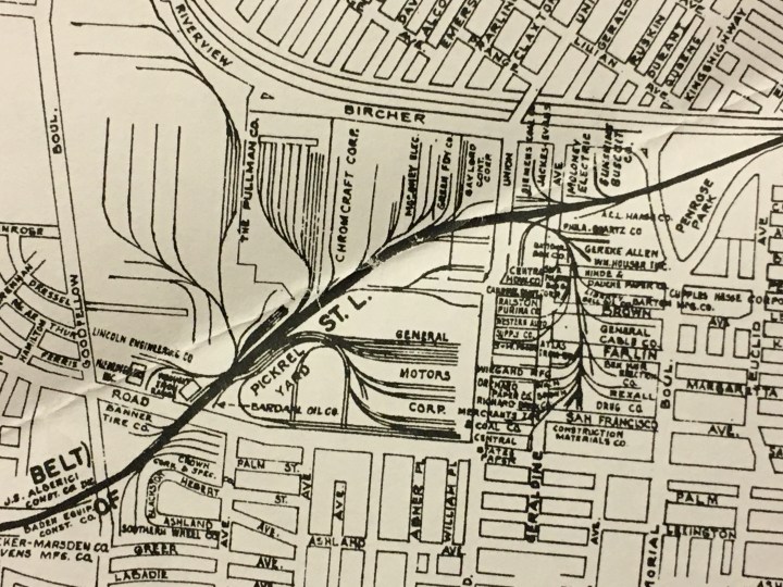
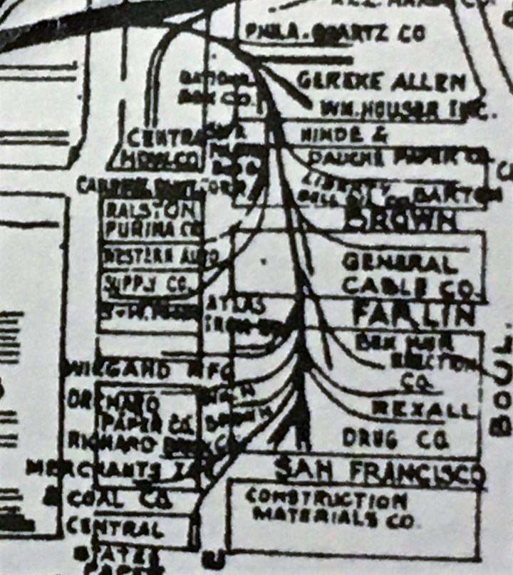
Below is an excerpt from a Terminal Railroad Association map, circa 1960. This map depicts some of the sidings and industries, although the detail is not so great. You should be able to match up the major industries above with their identities below. The complex of tracks in the upper left of the photo and the map are defense industry lines, with the famous ammunition plant at the very top left in the photo above.
Of particular interest to me is the small, heavily industrialized area that parallels Geraldine Street. In the photo above, this area appears at the center-right and looks like an artery with blood vessels spreading out in all directions. Below is an aerial close-up of the same area. The Belt Line can be seen crossing at top, right to left. Download this photo and study it. There are dozens of customers and box cars tucked in everywhere.
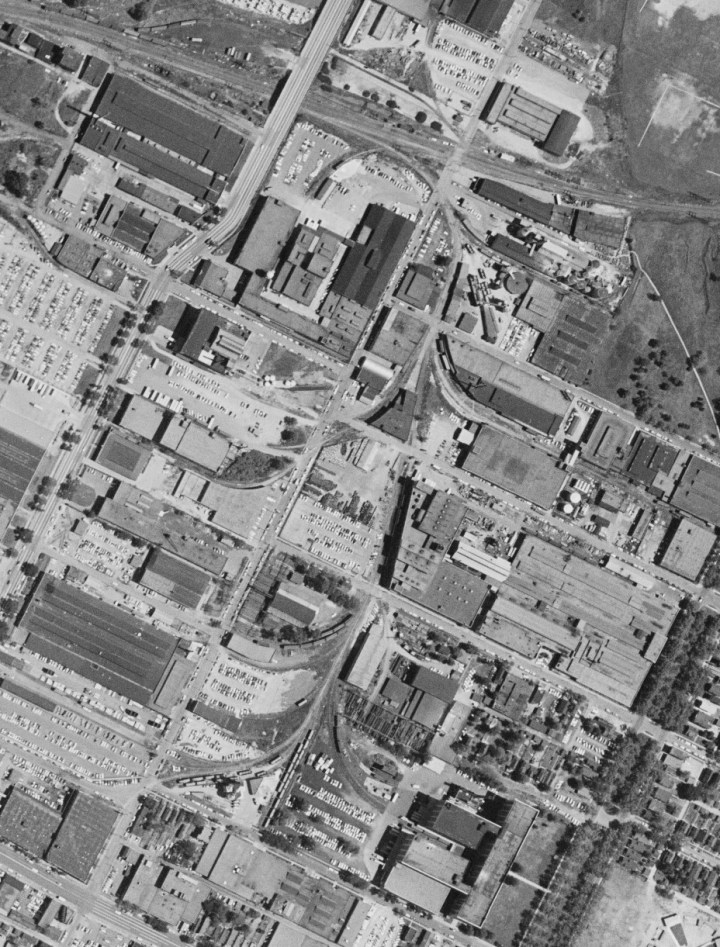
I have to admit that I lived in St. Louis for nine years and never knew this place existed until I bought aerial photos from the USDA last year. Here’s a fuzzy close-up below. Look at the amount of industry packed into this area, and all the branches radiating through the adjacent blocks.
Here is a closer view, below, of the top half of this district. Hoppers are at Philadelphia Quartz. Box cars are all over. Note the loading ramps extending out from some of the structures.
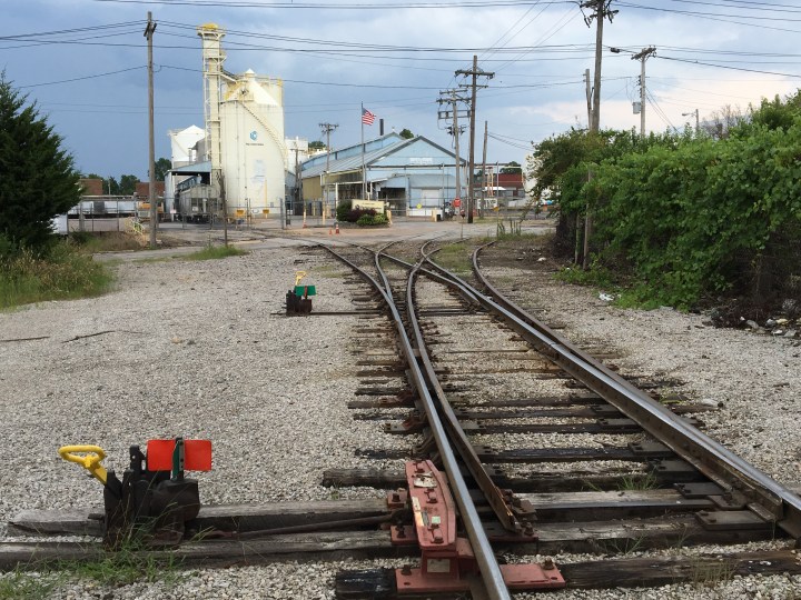
I visited the area a few years ago when I went back for a St. Louis RPM event. The lead off the Belt Line to this area still includes a three-way switch. See it in the aerial above?
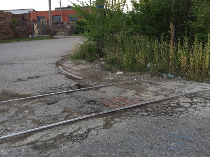
Below. Retired tracks are still everywhere. I imagine many of the streets were originally brick or cobblestone. That’s Richard Brick in the background; it has always been a major shipper on this branch. Many of the bricks were fired at a plant east of St. Louis–at Edwardsville, Illinois–which was served by the Nickel Plate.
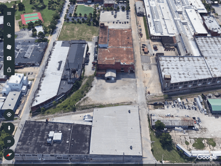
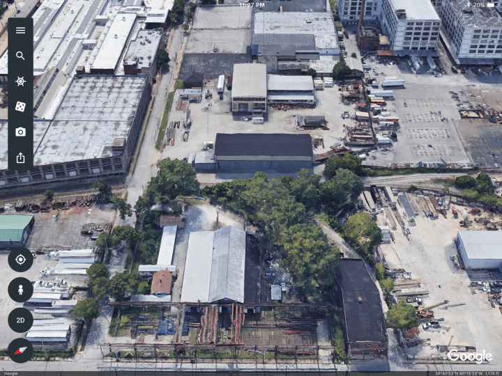
Below. Here’s a modern view of part of this area from Google Earth, looking east down Brown Avenue. I considered modeling this exact area. I like the big industries and how some of the buildings are truncated to allow tracks to pass by. I even considered modeling this area on a 4 x 8 and have deep sidings. That would be different, but it would consume a lot of space.
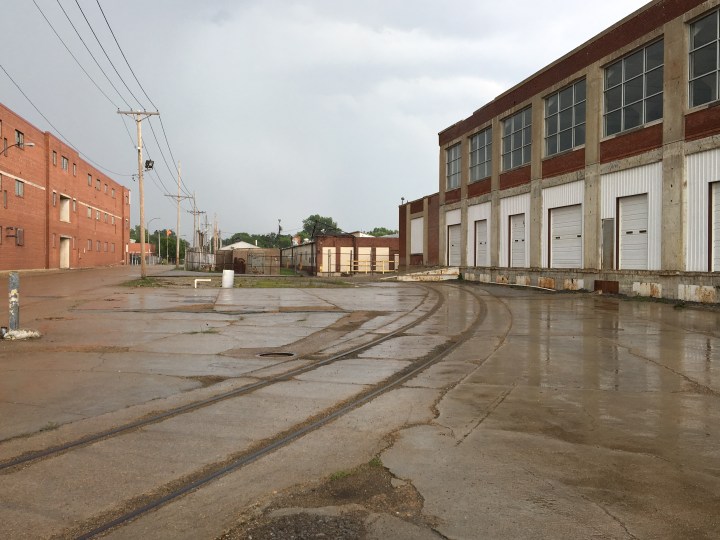
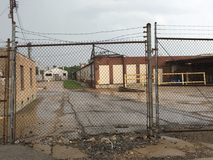
Below. Here’s a photo I took of the same area as seen above. Love the big buildings and the tracks in the street.
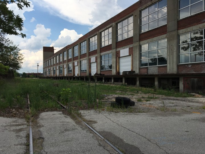
Many of the big factories are now abandoned, but the fronts look like this. The backsides of all these building were rail-served. This is American industrial architecture at it’s most best!

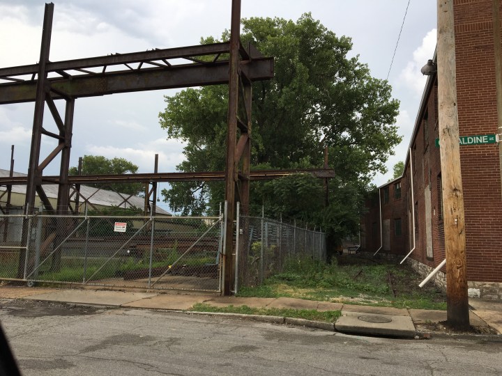
Some of the tracks crossing Penrose and Geraldine sneak through buildings and obstructions like this shown below. At left is a steel shapes distributor. It can be seen clearly in the aerial photos at top. They probably had loads delivered in gons. The building at right was curved to meet the track geometry.
Below. Here’s about the same area, thanks to Google Maps:
A few more snaps below, showing the variety of buildings and locations of tracks.
This old plant on Farlin Avenue, below–which I think used to be General Cable–is being reclaimed thankfully. I count at least seven loading dock doors for box cars.
I understand the Terminal Railroad Association Society had a paperback book published on the West Belt a few years ago, but I haven’t been able to get a copy from Larry Thomas despite my begging. That book may provide more information on the line and this area in particular.
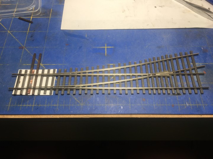
In preparation for the new layout I’ve been building a lot of new turnouts. Below is a #5, Code 55 under construction built with Central Valley tie strip, Micro Engineering rail and Proto87 Stores parts.
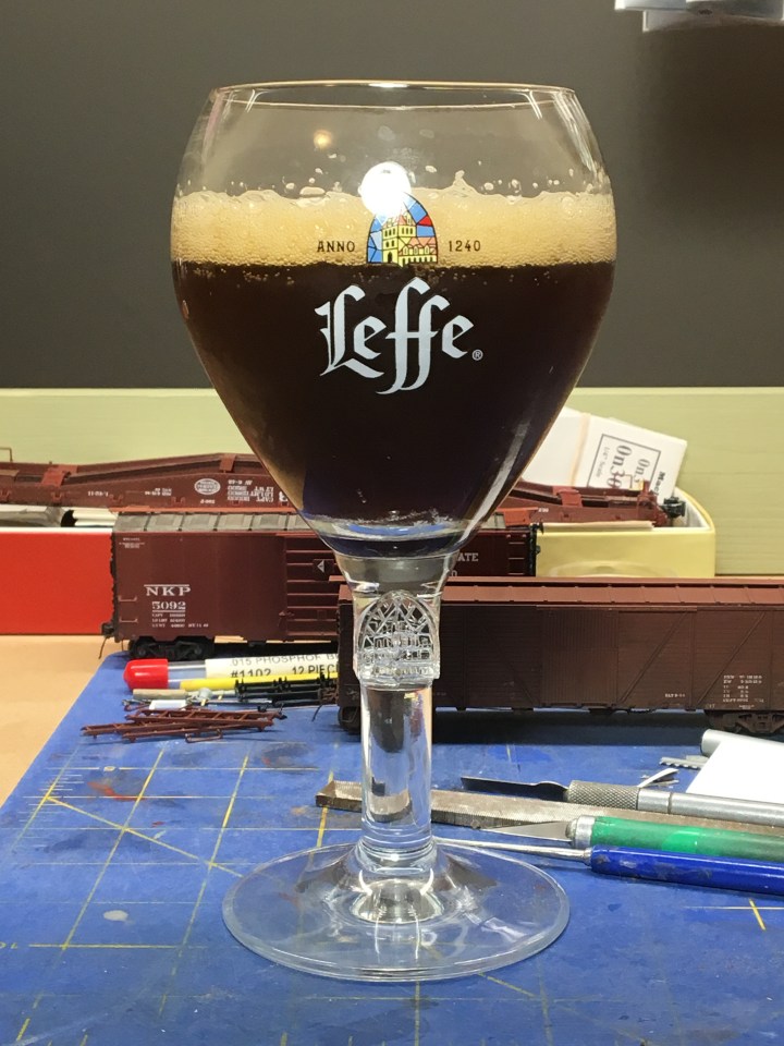
Progress is slow, unfortunately, thanks to my new Belgian friends Leffe, La Choufee and Westmalle.
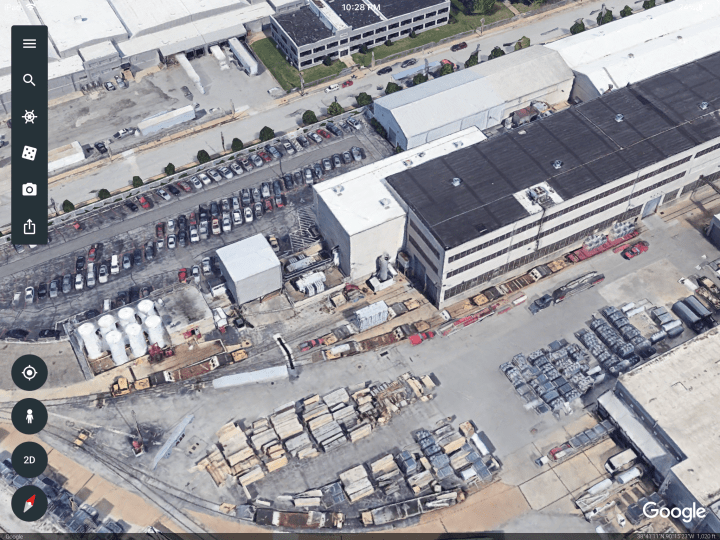
Oh, and here’s one last fun photo for you modern modelers, as seen on Google Earth. Check out this grab of a plant nearby the area discussed above, just off Union Avenue. Look at the tight track and all the transformer flats. I can see at least one Critter too. This place is a layout in itself!
With much gratefulness and admiration,
– John G

love the industrial concept, just like SAL’s downtown Columbus, GA that I would like to do
been looking at the NE like Philadelphia, Baltimore, or NJ across from NYC, particularly like the tight quarters and amount of industry in a small area
LikeLike