
A few weeks ago I got really frustrated trying to find Sanborn maps for some areas I’ve been researching in St. Louis. I’ve been trying to assemble material for a couple of blog articles on small layout ideas but have not been able to gather suitable information.
In frustration, about three weeks ago, I went back to the US Department of Agriculture website and ordered a complete set of their earliest available aerial photography for the entire St. Louis area. The process was so easy that I’m disappointed with myself for not doing it much earlier.
The USDA site can be found online at https://www.fsa.usda.gov/programs-and-services/aerial-photography/index. I e-mailed a request, carefully following the instructions on their site, and included a map that highlighted the areas I was interested in. I also told them I preferred digital copies since hard copies are much more expensive and take longer to print and deliver.
I got a response from Linda Cotter at the USDA the following day. She sent me an entire set of 28 photos for the St. Louis and East St. Louis area for just $25. The images are from 1955 through 1958. The images are TIFs; they’re about 400 megabytes each and were sent on a thumb drive and arrived here in Germany in just eight days. It was necessary to crop them down and convert them to JPEGs to present here.
Here’s an example of the photos. The image below is at the where the MacArthur Bridge lands on the west bank of the Mississippi. The area just south of the bridge has always intrigued me. In the transition era there was a maze of track with warehouses and industries everywhere. Soon after these photos were taken, the area north of the bridge was obliterated to fit in a massive interstate highway bridge and junction, and also the Gateway Arch park.

Here is a view of the same area, below, from the Barriger Library collection on Flickr.
The photos are fascinating. They answer a lot of questions I have had about St. Louis’s rail history and local industries. In the photos, all the yards are still in place, all the roundhouses can clearly be seen, and nearly all of St. Louis’s famous industries are right there in black and white.
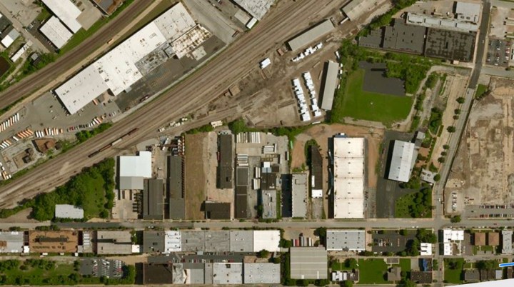
Below is an area I’ve been studying for years, just off the Missouri Pacific about a mile west of St. Louis Union Station. I like the yards and the tracks curving sharply into the factories
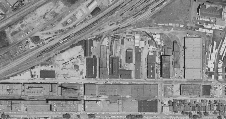
The image below is the same area today, from Google Earth.
There are some other cool things to be seen—or not seen—as well. Landmarks like the St. Louis Browns stadium, the original Monsanto plant, the ACF plant next to the Budweiser brewery, and East St. Louis in all it’s economic greatness (no kidding!) can be seen. There are no hideous Interstate highways, no Poplar Street Bridge, and no Gateway Arch
By the way, the earliest photos maintained at the USDA date to about 1955. If you want earlier photos, you’ll have to talk to the National Archives in Washington D.C. The good news about the USDA collection is that it is virtually complete in it’s coverage of the United States.
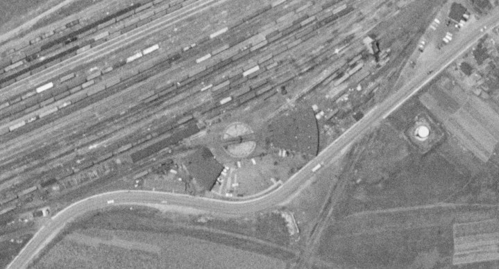
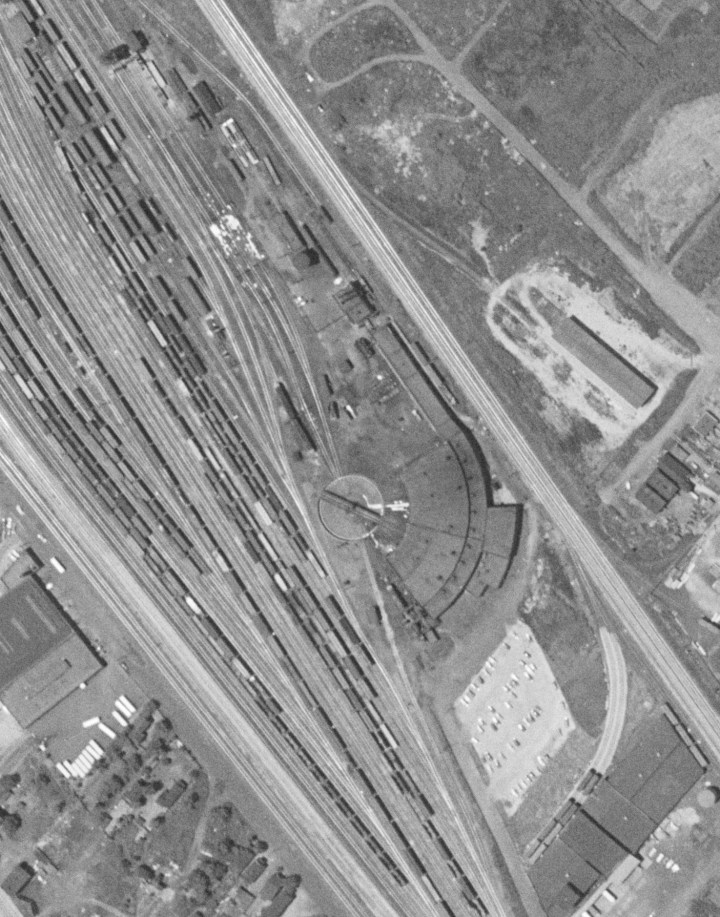
Below, the B&O Cone Yard roundhouse, which was still standing along I-55/70 in East St. Louis the last time I was in town in 2017. The PRR main line runs through the center of the photo behind the roundhouse.
The imagery isn’t quite as sharp as what you can get on Google Earth for example, but they’re good. In almost all cases you can make out tracks, rolling stock, and other details.
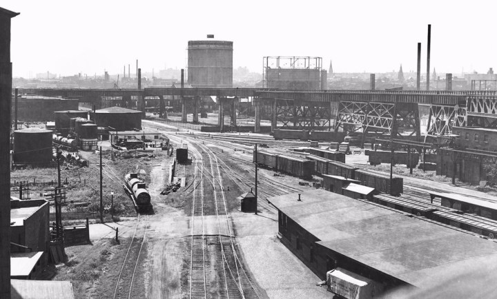
Below. I’ll have to talk to Ed Hawkins about this one…but I think this is the ACF plant on the Missouri side. Can anyone help me confirm this? On the right along the river is the Missouri Pacific main, and at the bottom left is part of the compact Manufacturer’s Railway yard that served the A-B brewery.

There is so much more in the photos that I can’t share here. They’re priceless for the prototype modeler and researcher. And at just twenty five bucks, they’re worth every penny. – John G

Did you try the USGS Earth Explorer site? https://earthexplorer.usgs.gov/
LikeLike